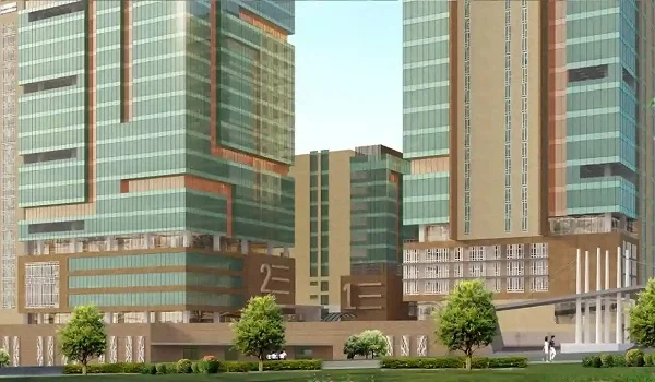
Sattva Centralis Connectivity
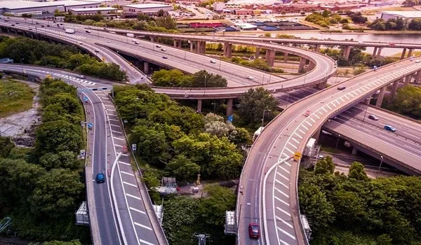
Sattva Centralis connectivity rests on the Bommasandra-Jigani Link Road, which links it to Electronic City and NICE Road. Electronic City's nearer phases sit about 2.5 km away, and the EPIP Zone is about 3 km away. NICE Road is about five minutes by car, and the Bommasandra metro sits 3 to 4 km away. Schools, hospitals and daily shops are all a short drive from the project.
For most buyers, travel time decides how each weekday feels. This guide lists the distance to offices, the metro, schools, hospitals and the airport. It also covers the new roads and metro plans that will help Jigani in the coming years.
Sattva Centralis Connectivity at a Glance
Sattva Centralis sits on the Bommasandra-Jigani Link Road in Jigani, South Bengaluru. Electronic City is 2.5 to 9.7 km away, and NICE Road is about five minutes by car. The nearest metro is 3 to 4 km away, and the airport 42 to 60 km away.
| Destination | Approximate Distance |
|---|---|
| EPIP Zone / Jigani IT Hub | 3 km |
| Electronic City (near to far phases) | 2.5 to 9.7 km |
| Brigade Tech Park / RMZ NXT | 4 to 5 km |
| HCL and Toyota belt | 4 to 8 km |
| Bommasandra Industrial Area | 8.9 km |
| NICE Road | About 5 minutes |
| Yellow Line metro (Bommasandra) | 3 to 4 km |
| Kempegowda International Airport | 42 to 60 km |
These distances are to the wider area and change with your route and traffic.
Road Connectivity
The Bommasandra-Jigani Link Road is the main way in and out. It joins the Jigani industrial area with Bommasandra and Hosur Road. Hosur Road then carries you to Electronic City and Silk Board. For daily trips, this road saves you long detours through small village roads.
Jigani also links to Bannerghatta Road through State Highway 87, which meets the link road at APC Circle. From there, you can head north towards Hulimavu and Gottigere. At Gottigere, SH 87 meets NICE Road. From there, you reach Mysore Road and Tumakuru Road without entering the city centre.
Metro Connectivity
The Yellow Line gives Jigani residents a steady public transport link. It opened in August 2025 and runs about 19 km from RV Road to Bommasandra. The line has 16 raised stations, including Electronic City, Hosa Road and Silk Board.
From the project, the Bommasandra end of the line is about 3 to 4 km away. At RV Road, the Yellow Line meets the Green Line, so you can reach Jayanagar and Majestic. In August 2025, the state also said it would look at a metro extension towards Jigani.
Connectivity to Workplaces
The project puts a large share of South Bengaluru's jobs within a short drive. This keeps weekday travel easy for most residents.
- EPIP Zone and Jigani industrial area: About 3 km, home to many factories and tech firms.
- Electronic City: About 2.5 km to its nearer phases, with firms such as Infosys and Biocon.
- Brigade Tech Park and RMZ NXT: About 4 to 5 km away.
- HCL and Toyota belt: About 4 to 8 km away.
- Bommasandra Industrial Area: About 8.9 km away along Hosur Road.
If you work in these hubs, a short drive replaces a long city commute.
Schools Near Sattva Centralis
Families will find several well-known schools close by. This keeps the daily school run short and easy to plan.
| School | Approximate Distance |
|---|---|
| Inventure Academy | 3 km |
| Jigani Global School | 3 to 3.9 km |
| Tapovan High School | 3 to 3.9 km |
| Deens Academy | 4 to 5 km |
| Redbridge International Academy | 4 to 5 km |
| The International School Bangalore (TISB) | 5 km |
Hospitals and Daily Needs
Jigani has good hospitals close at hand. Columbia Asia and Indira Hospital lie 3.5 to 4 km from the project. Manipal Hospital Jigani is about 5 km away. Narayana Health City, a large hospital campus, sits about 8 to 11 km away.
For daily shopping, Jigani's local markets and D-Mart are close by. For weekend trips, Royal Meenakshi Mall is about 21 km away and Gopalan Innovation Mall about 24 km.
Airport and Railway Access
The airport is the one long trip for residents here. Kempegowda International Airport lies 42 to 60 km away, based on your route. The drive often takes about 90 minutes in normal traffic.
For train travel, Bengaluru City railway station is about 28 km from Jigani. Many residents take the Yellow Line and Green Line to reach Majestic without driving.
Upcoming Upgrades Around Jigani
Travel around Jigani should keep getting easier. The planned metro extension would bring a station closer to the town itself. Planned ring roads across the city's outer belt should also cut travel time to east and west Bengaluru.
By the time homes reach owners from December 2030, these upgrades could make daily travel easier still. You can see the full location map on the Sattva Centralis location page.
FAQs
Sattva Centralis has strong road and metro links. It sits on the Bommasandra-Jigani Link Road, about five minutes from NICE Road. The Bommasandra metro is 3 to 4 km away, and Electronic City is about 2.5 km away.
Sattva Centralis is about 2.5 km from Electronic City's nearer phases and 9.7 km from the farthest. Your travel time depends on where your office sits, your route and the traffic on the day.
The nearest metro is the Bommasandra end of the Yellow Line, about 3 to 4 km away. The line runs about 19 km to RV Road. There, you can switch to the Green Line for Jayanagar and Majestic.
Kempegowda International Airport is about 42 to 60 km from Sattva Centralis, based on your route. The drive often takes about 90 minutes in normal traffic. NICE Road helps you skip much of the city centre traffic on the way.
Inventure Academy is about 3 km away. Jigani Global School and Tapovan High School are 3 to 3.9 km away. Deens Academy and Redbridge International Academy are 4 to 5 km away. TISB is about 5 km away.
In August 2025, the state said it would look at taking the Yellow Line on to Jigani. It is still a plan today. For now, residents use the Bommasandra end of the line, about 3 to 4 km away.